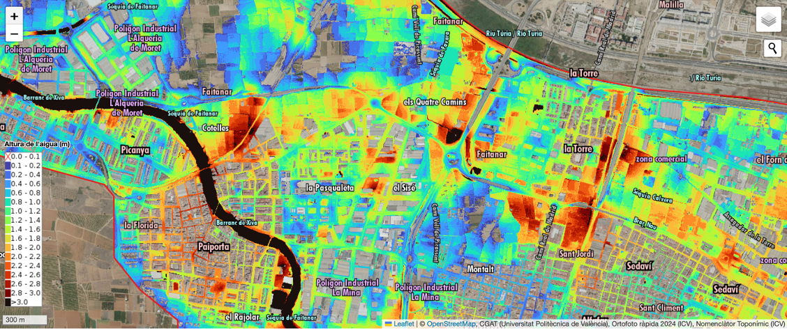
The Geoenvironmental Cartography and Remote Sensing Group (CGAT) from Cartographic Engineering, Geodesy and Photogrammetry Department of the Universitat Politècnica de València (UPV), along with the ETSI Geodesic, Cartographic and Topographic ETSI has prepared this map of the flooding depths in l’Horta Sud after the episode of October 29, 2024. This work, developed as a volunteer act, aims to provide useful information for the affected municipalities. It attempts to offer a better understanding of the event and to constitute a key tool for future flood management
Street by street flood map of l’Horta Sud 2024