
Interuniversity Doctorate in Geomatics Engineering
Responsible structures
The growing volume of geomatics information requires new and diverse skills to ensure that it can be exploited efficiently and to the maximum, so the need for research, development and innovation is present in all organizations that want to be competitive in Spain and Europe. One of the most appropriate ways to be competitive in R+D+i is to train highly qualified and competent people in research and development, which should be developed through a structured and defined doctoral program.
In this way, and in close collaboration between two Polytechnic Universities, theInter-University Doctorate Program in Geomatics Engineeringmanaged by the Cartographic Engineering, Geodesy and Photogrammetry Department (UPV) and the Escuela Técnica Superior de Ingenieros en Topografía, Geodesia y Cartografía (UPM).
The department has more than 40 PhD professors with active national and international projects, and we also have the following collaborating entities:
European Space Agency (ESA – ESAC), National Center of Geographic Information. Instituto Geográfico Nacional, Centro Superior de investigaciones Científicas, Centre Tecnològic de Telecomunicacions de Catalunya, GeoNumerics, Institut Cartogràfic Valencià, Instituto Andaluz de Patrimonio Histórico, Leica Geosystems S.L., Topcon Positioning Spain, S.L.U., Trimble Navigation Ibérica.
Lines of research
The doctoral thesis can be carried out in any of these lines of research:
Spatial observation, mapping and environmental applications
- Automatic updating of land cover databases: development of feature extraction methods and classification methods.
- Automated geomorphometric characterization of the territory by means of GIS and remote sensing, especially aimed at highly dynamic natural areas such as beaches, dunes and waterways.
- Automatic generalization and mapping on new media (mapping applications on mobiles)
- Extraction of agro-forestry parameters using LIDAR and high and medium resolution images.
- Geographical analysis, land use planning and heritage management.

Modeling and Geocomputing
- Near object photogrammetry and terrestrial laser scanning (topography, 3D modeling, monitoring and geometric control in civil engineering, industry, medicine and heritage).
- Integration of multisensory information.
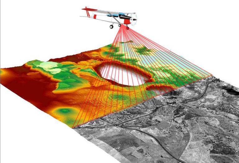
- LIDAR/airborne laser scanner and UAV/RPAS/UAS/drones aerial platforms for new applications.
- Spatial databases, spatial data infrastructures, spatial data production
mapping. - Cartographic data models and INSPIRE directive.
- Web-based Geographic Information Systems (WebSIG) for Multiple Applications
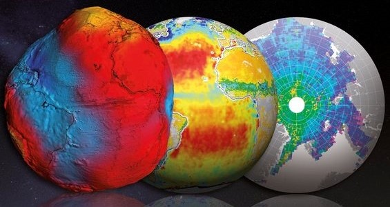
Geodesy and Geophysics
- Monitoring and determination of ground and infrastructure deformations
- Atmospheric monitoring with GNSS
- Applied Geophysics and Subsurface Mapping
- Precision Point Positioning (GNSS-PPP)
- Seismic characterization of sites, seismic hazard and risk
- Modeling errors and systematic effects in GNSS observations
Information of interest
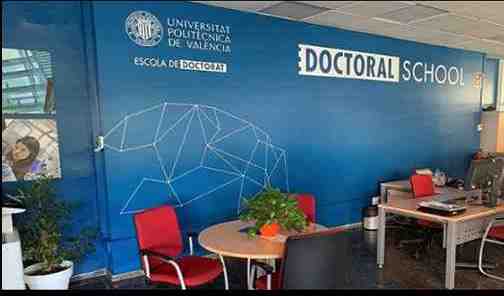
UPV Doctoral School
The UPV Doctoral School coordinates the joint UPV-UPM interuniversity doctoral program. Here, you can apply for registration, as well as consult the UPV regulations, the formation of research teams, and general procedures.

Doctoral school documentation
Documentation provided by the doctoral school regarding the PhD program in Geomatics Engineering, such as enrollment process, access conditions, academic regulations, etc.
Department specific documentation
Specific documentation prepared by the department’s doctoral academic committee, such as guidelines for the preparation of the research plan, history of research stays, evaluation of activities, etc.